![]()
![]()
After your first nights' stay at Onuku Farm Trampers' Hut, the Banks Peninsula Track climbs up and over the crater rim surrounding Akaroa Harbour. From there it descends through native forest to the Pacific Coast and penguin colony at Flea Bay.
The Track then follows the dramatic coastline, via clifftops and bays including the Seal Cave and shelter before reaching Stony Bay for your second night's stay.
Your second days walking continues around the coast visiting tranquil Sleepy Cove before reaching the sandy beach of Otanerito. From there you turn inland and ascend once more through both the regenerating and ancient forest of Hinewai Reserve before cresting the crater rim at Purple Peak saddle and descending to Akaroa.
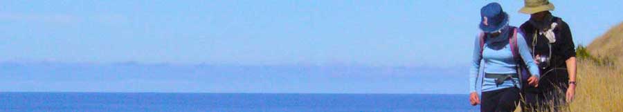
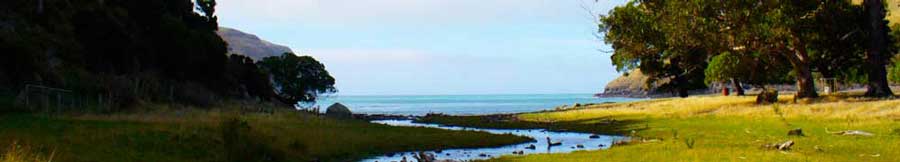
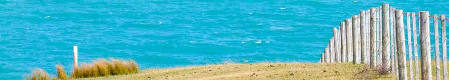
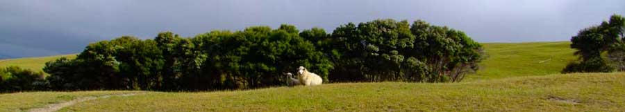
The Track route is wonderfully diverse, passing through lush native bush and beech forest, with waterfalls and birdsong, and crossing open pasture with stunning panoramic views.


Landcrossings. Onuku Farm. Onuku Heights. DOC Reserves. Flea Bay Farm.
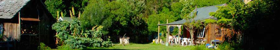
You quickly gain height after passing the Onuku farm buildings following the grass farm road to the abandoned site of Paradise Farm. Continue up through open pasture with stunning views of Akaroa Inner Harbour until finally reaching Trig GG, the highest point on the walk. From here on clear days there are views over to the Southern Alps. Soon after there is a walkers' shelter, before you cross over the crater rim. A brief road section starts the descent into Flea Bay, you turn off at Mortlock's Mistake, following the stream through conservation reserves with red beech and regrowth hardwood forest, and a series of four waterfalls, (access behind the veil of the last one) before emerging into the grazed land of the valley floor. In the last 20 minutes you pass Nikau palms at their southernmost limit. The cottage for your lunch stop is just 200m from the beach and Pohatu marine reserve.


Landcrossings. Onuku Farm. Onuku Heights. DOC Reserves. Flea Bay Farm.
Onuku - Flea Bay. 11 kms, 4-6 hrs
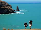
The Track leaves Flea Bay by climbing to just 150 metres altitude and then traversing along the eastern side of the bay above Pohatu marine reserve, giving good views, with seats provided for dolphin and penguin viewing. The narrow track continues on through the DOC penguin sanctuary area and rounds the tip of the headland before reaching the gully above Island Nook. From here it follows the dramatic clifftop route to the iron oxide stained cliffs of Redcliffe Point before dropping down to the 'Gull and Shag' shelter built against the rock wall. You cross a stream here, near the Seal Cave, a reliable haunt of fur seals, often swimming and playing with their young amongst the rocks or curled up asleep in the cave. The track climbs steeply after this to the ridge (with great views to Pompeys Pillar to the north), and then follows round the coast before a steep descent brings you down onto the beach. You cross the small creek and walk a hundred yards up the valley to the Stony Bay cottages where you will spend your second night.


Landcrossings. DOC Penguin sanctuary. Opatuti Farm (Stony Bay).
Flea Bay - Stony Bay. 8 kms, 2-4 hrs
From Stony Bay you climb briefly through regenerating coastal forest (penguin sanctuary) before heading out to Blowhole Point (where in favourable conditions the sea whooshes up through a small hole in the rock shelf). You then swing inland again past rock-walled Blind Bay, up a bushy gully, and out to the southern headland of Sleepy Bay with its spectacular view of the Sea Arch (now sea spike after the earthquake). Sheltered Sleepy Bay is in delightful contrast, its high bush-girt waterfall is just a couple of minutes off the main track. You cross one more spur, passing the site where Ngai Tahu warriors fought a decisive battle with Ngati Mamoe some 300 years ago, before joining the broad farm track down to Otanerito beach.


Landcrossings. Opatuti Farm. Renegat Farm.
Stony Bay - Otanerito Beach. 6 kms, 2-3 hrs
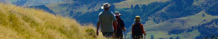
The first kilometre from Otanerito beach is through farmland alongside the creek, but for most of the way upvalley the route traverses Hinewai Reserve through extensive regenerating native forest and some mature old-growth beech forest. The gradient is gentle at first, following the lower reaches of Narbey Stream, with short sidetracks leading to waterfalls. The second half of the ascent is steeper but under shady forest canopies. Eventually you emerge into a parkland of native trees and pasture at Brocheries Flat, before making the last short climb to Purple Peak saddle, 590m above sea level. Akaroa Harbour spreads out below you like a satellite image. For the energetic, a 40 minute steep side track leads to the even loftier viewpoint of Taraterehu, or Stony Bay Peak, 806m. From the saddle the track descends quite steeply through grassy farmland gullied with native bush and surrounded by spacious views in all directions, finally entering town by Mt Vernon Lodge and Rue Balguerie.


Landcrossings. Renegat Farm. Hinewai Reserve. Miessen. Purple Peak Track (public).
Otanerito Beach - Akaroa. 10 kms, 3-5 hrs

